
Mark posted on the forum that we planned to leave earlier for Mud Island and from the Boat Passage instead of Wynnum as this would allow us to catch the last of the outgoing tide via the Brisbane River. We were last at the Port of Brisbane boat ramp carpark despite being there well before 7:00AM for a 7:30AM departure. I was annoyed when Mark was asked, before we had even left, what time we expected to be back. As far as I was concerned it sometime later today. To yet be determined by what was out there, the conditions and some random inspiration, maybe even the need to have a dawdle. If someone had to be back by a particular time, then they could ensure that they met their schedule. I resented the idea of moulding my Sunday paddle to suit their requirements which, as it turned out, was for their exclusive (monetary) benefit. Mark politely engaged the question and said not before 2:00PM if we were to return via the Mangrove Passage, as it would not be until around 1:30PM that there would be around the 1.5m of water needed to clear this muddy cesspit.
The port was busy with a variety of ships. One bulk carrier had a large bucket suspended on a crane hanging over the port side. It looked like it could pluck a kayak out of the water no problem, either that or pummel it into oblivion should it let go. A couple of crew waved cheerfully. Channel 12 noted the departure of local vessels for Moreton Island and issued a couple of ships their pilot related instructions, administering the obligatory battery of Covid19 related questions without sounding too much like a bored or stunned mullet.
We paddled into a very light NE towards Mud Island. At one time a dolphin did a spectacular leap out of the water, so high that it was silhouetted against the sky above the island’s treeline. This trip had all the hallmarks of an Ian paddle. The island was girt by coral and plenty of it. Several in the group did not want to risk scratching their boats so we continued clockwise to the northern beach. This is a beautiful place on a big blue sky day. Slight hassle is that there is no shade on the beach which rapidly disappears on a flood tide. We sat in the shade of a mangrove for a combined morning tea and lunch. This was made a lot easier and more relaxing for us as Mark had bought chairs and table as well as an anchor. By the time lunch was declared over three boats were already nudging each other and tugging gently on the anchor.
The visibility had improved with the incoming tide. There were quite a few schools of smaller fish and the odd larger one amongst the coral rubble and seaweed. The NE lagoon was only just starting to fill and the eastern creek might have been accessible at a pinch. Richard radioed from up ahead that they were passing by the main entrance to the lagoon and that it was too shallow to go in. Too shallow – utter codswobble – more like he didn’t want to scratch his boat. There would be enough water. We had gone in at a time when the entrance to the eastern creek had dried to a coral bank. Jack, Mark and I went in. Volleys of fish torpedoed out around us as the tide swept us into the main body of the lagoon. It was calm and shallow giving us an unfair advantage in creature spotting. Turtles and rays abounded. Even little critters put up an impressive bow wave. Another red kayak was spotted in the distance. Dale had decided to turn into another entrance. He had not seen the whale bones so we detoured via the southern creek where the pungent remains of a minke whale are strewn in the shallows at either side of the mouth of the creek. There is not much left to see of the two humpbacks further upstream.
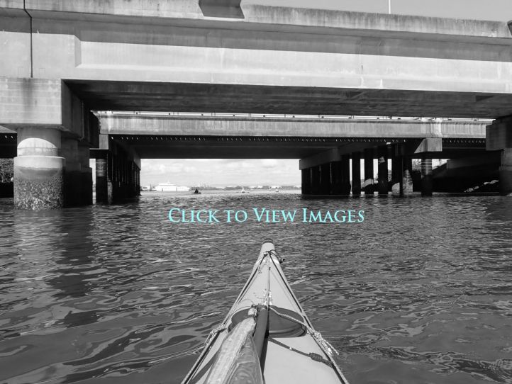
Then it was GPS lesson 201 on how it is still useful even when the SD card dropped out when you last changed the batteries. The homing devices were set to the Mangrove Passage. For those of us without it was a bearing of around 210 degrees. The sails went up but only became useful once out of the lee of the island. We made a reasonable 8 to 9Kph with the NE behind us arriving at the entrance of the passage at 13:36PM. At the entrance the water was a paddle blade deep – right on the limit of what you need to get through. Mark’s calculation was spot on. The muddy hump only just let us though. Then we were out into the NE with a sailing finish bringing us ashore at 2:01PM.
So it turned out to be a good and accurate estimate of timing. Something that comes with experience. I had a doddle and drift and another chance to check out he minke remains. Paddling to a schedule is over to the individual. It is unreasonable to ask the group to paddle to your needs unless your needs happen to work in with them as well. Either that or maybe I got out of bed too early.
